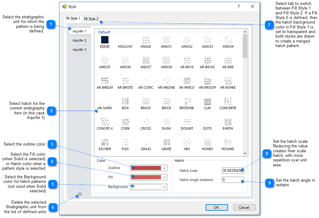
In EnviroInsite, the term Stratigraphy refers to the regional geologic or hydrogeologic units that are likely to be continuous between boreholes. To impose consistency on the hatch patterns used to represent particular units between different plots, the stratigraphy hatch patterns are set at the document level. To set the hatch patterns, select Edit> Format>Stratigraphy from the main menu. Note that for each unit, two hatch patterns may be selected. If anything other than SOLID is selected for Fill Style 1, then the final printed hatch pattern will be the combination of the Fill Style 1 and Fill Style 2 hatch patterns.
