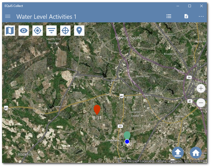
The map in the Collect Mobile app can display which locations have completed sampling records. In the image below, the completed sampling location B-30 is shown with a green pin and the uncompleted sampling location B-31 is shown with a red pin.

A custom field in the template can be used to change the color of the pin locator based on record completeness.
Note: The template must include a field that contains a geography field that is either populated from the geolocation field in the Collect Field EDD report, or from a geography field where the user adds the coordinates. |
|---|
1.Create a custom field in a template named something like "complete_yn". Set the field type to Formula. Create a formula similar to the following:
NOT(ISNULL([SYS_LOC_CODE],[WATER_LEVEL]))
This field will return TRUE if the SYS_LOC_CODE and WATER_LEVEL fields in the formula are populated. Any Boolean formula can be used in this field.
a.To hide this field, set the Visible Attribute to FALSE.
b.You can also use the field in the Grid View to show quickly which records are complete, outside of a map view.
2.Click the Map Setup button to open the map style configuration.
3.Set the Map Field to the template's geography field.
4.The default formula displays red pins for each location. The following formula will display green pins if the complete_yn field from Step 1 returns TRUE, and red pins if the field returns FALSE.
IF([complete_yn],CONCAT('{','"View":"PinText",','"PinColor":"#5dad88",','"TextColor":"#ffffff"','}'),CONCAT('{','"View":"PinText",','"PinColor":"#cc3300",','"TextColor":"#ffffff"','}'))